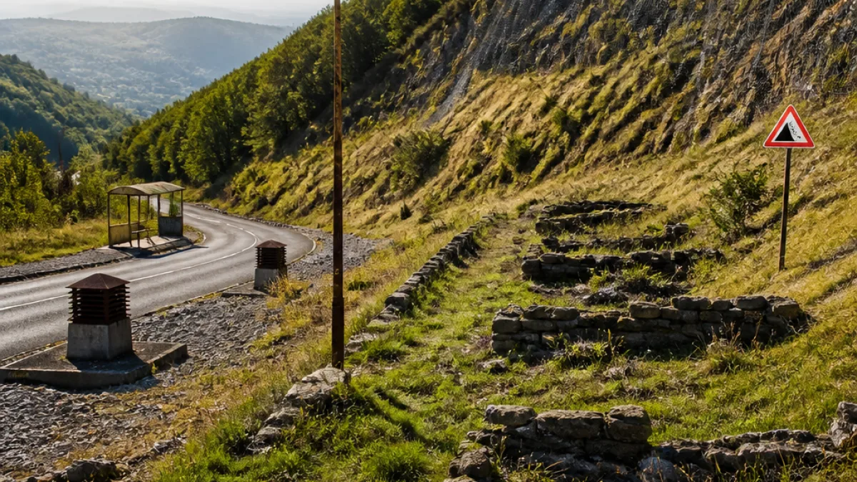
A community removed for safety
In the mid-1980s, a small south Wales Valleys settlement — Troedrhiwfuwch, affectionately known as “Troedy” — disappeared from official maps and everyday life alike. The village, comprised of 94 houses across three streets and home to an estimated 600 residents, was demolished in 1985 following longstanding fears that the ground above and beneath it could not be trusted.
Set against the lower slopes of Cefn Brithdir, Troedrhiwfuwch was typical of many tight-knit Valleys communities that grew around industry and kinship. Residents recall a place where families were interwoven across generations and daily life revolved around the village’s social and civic anchors — two pubs, a church, a chapel, a library, a school and a shop with a post office. Yet its very setting, cherished for its proximity to hillside and moor, also brought an accumulating series of risks that officials ultimately judged too great.
Why Troedrhiwfuwch was flattened
While comparisons were drawn at the time with the horror at Aberfan — where a spoil tip collapse killed 144 people in 1966 — local decision-makers have stressed that Troedrhiwfuwch’s danger was of a different nature. There were no coal tips above the village. Instead, concerns centred on complex geology, the gradient of the local pennant sandstone, and evidence of ground movement extending back decades.
“No coal tips involved. A complex series of faults, allied to the pitch of the pennant sandstone, meant there was a danger that a major landslide might occur... There was also evidence of slippage and subsidence, caused by mine workings in the valley below. A sad story but necessary.”
That assessment, offered publicly by Elgar Lewis, a former chair of planning and vice-chair of the now-defunct Rhymni Valley District Council, underlines the multi-layered nature of the risk. Accounts also refer to erratic boulders left by ice sheets, weathered rockfalls and a long history of subsurface disturbance associated with past mining. The mountain itself — known locally as the Brithdir — had been observed as ‘on the move’ well before demolition was mooted. As far back as February 1906, newspapers were reporting concerns linked to instability on the hillside.
Decisions shaped by memory and terrain
For communities across the Valleys, the Aberfan disaster forms a permanent backdrop to any discussion of hillside safety. In Troedrhiwfuwch’s case, officials faced the prospect of an unpredictable failure mechanism tied to faults and slopes rather than spoil. The judgement in 1985 was that removal, however painful, was the only way to eradicate the worst-case scenario.
Residents were dispersed, homes were cleared and, over a short span, Troedrhiwfuwch shifted from lived geography to local memory. Families carried with them the bonds and stories forged in the village’s streets and meeting places, even as those streets vanished from view.
What remains and what it tells us
Beyond the sorrow of a lost place, Troedrhiwfuwch’s fate is a reminder of how geology, heritage and public safety intersect in former coalfield areas. It illustrates how slowly accumulating evidence — repeated rockfalls, signs of slip and subsidence, and the structural peculiarities of layered sandstone — can culminate in an irreversible planning decision.
The story continues to resonate because it touches on themes many in the Rhymney Valley and across Caerphilly County Borough know well: the tension between settlement and slope, the legacy of mining beneath our feet, and the duty of care owed to communities living with those legacies.
Troedrhiwfuwch at a glance
| Feature | Detail |
|---|---|
| Location | South Wales Valleys, at the foot of Cefn Brithdir |
| Population | About 600 residents |
| Housing | 94 dwellings over three streets |
| Community amenities | 2 pubs; church; chapel; library; school; shop & post office |
| Key risk factors | Geological faults; pitched pennant sandstone; rockfalls; historic mining-related subsidence |
| Outcome | Village demolished in 1985 due to landslip concerns |
Lessons for the Valleys today
- Risk is cumulative: Small, repeated signs of ground movement can build a persuasive case for intervention.
- Context matters: Not all hillside dangers stem from spoil tips; natural geology and old workings can combine to destabilise slopes.
- Community legacy endures: Even where places are removed for safety, their history and networks persist in the wider area.
Four decades on, the name Troedrhiwfuwch still carries weight in the Rhymney Valley. It marks a point where civic responsibility and geotechnical reality met — and where, in the balance between cherished homes and the possibility of disaster, decision-makers opted to act before tragedy could strike.