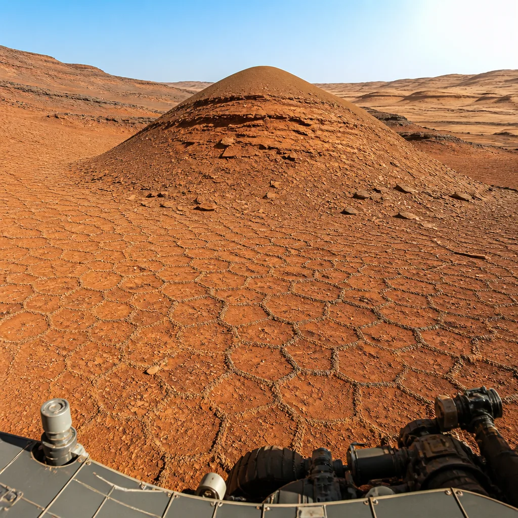
NASA’s Curiosity rover has photographed an unusually extensive patch of small, polygonal surface features while ascending the foothills of Mount Sharp, the mission team reported on 29 July 2026. The images, taken on sols 4,930 and 4,931, form a 360-degree panorama that reveals shapes typically 5–10 centimetres across clustered over a wide area.
What was observed
The panorama was produced from 340 individual Mastcam frames stitched together and colour-balanced to resemble how the scene would appear to the human eye on Earth. Across the central portion of the mosaic, the surface is dominated by small, honeycomb-like polygons that also wrap around a sand-capped butte the team has nicknamed “Miraflores”.
Why polygons matter
Polygonal textures on planetary surfaces can arise from multiple processes. On Mars, such patterns have been attributed variously to:
- Desiccation — cracking as wet material dries (analogous to mud cracks),
- Thermal cycling — repeated expansion and contraction with temperature swings,
- Compaction or shrinkage following burial and later exposure, and
- Mineral transformations that alter volume as chemistry changes.
Scientists working with the Curiosity team are measuring key characteristics of the polygons — such as size, shape, and relationships to nearby sediments — to narrow down which mechanism or combination of mechanisms produced them in this location.
Context within the mission
Curiosity has encountered polygonal textures before, but the concentration and small scale of this field are notable. The rover has been ascending Mount Sharp, a roughly 5-kilometre-high central peak within Gale Crater, since 2014, and the new set of images adds to a long record of sedimentary and erosional processes sampled along that climb.
| Item | Value |
|---|---|
| Sol numbers | 4,930–4,931 |
| Polygon size | ~5–10 cm across |
| Panorama frames | 340 Mastcam images |
Implications and next steps
The immediate scientific value of the observation lies in constraining environmental conditions at the time the textures formed. If the polygons are the product of past wetting and drying, that would add to evidence for episodic liquid-related processes in Gale Crater’s history. If thermal or mechanical stresses are responsible, the finding would instead speak to climate-driven or burial-and-exposure cycles.
Mission scientists will combine the Mastcam photography with other Curiosity datasets and contextual geology to test hypotheses. The instrument team at Malin Space Science Systems supplied Mastcam and the rover itself was built and is operated by teams led by NASA’s Jet Propulsion Laboratory and managed by Caltech on behalf of NASA’s Science Mission Directorate.
The new imagery is a reminder that even after many years on Mars, Curiosity continues to return observations that refine our understanding of the planet’s surface processes and past environments.